
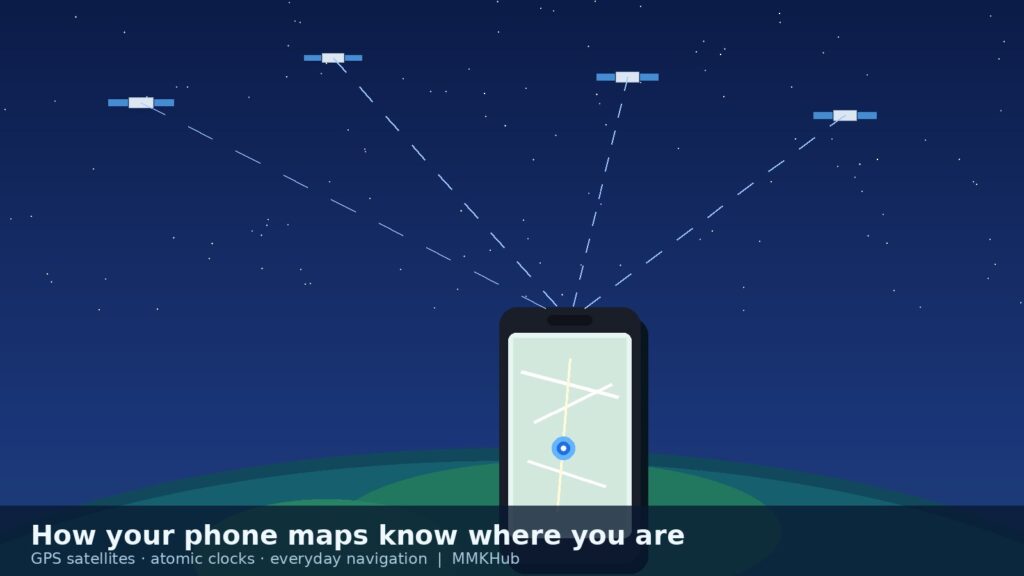
You step out of a bus in a city you barely know. Open Maps. Wait two seconds. A blue dot appears on a street you have never walked — and somehow it is you.
That quiet little circle is not a guess from the phone company. It is a handshake between your handset and a fleet of satellites thousands of kilometres overhead, timed by clocks more precise than anything in a factory locker room. Here is the plain science behind how your phone maps know where you are — and what that means when you work or take a day off in Thailand, Singapore, Malaysia, New Zealand or Australia.
မြန်မာအကျဉ်းချုပ်
ဖုန်းပေါ်က မြေပုံ အပြာစက်က မှော်မဟုတ်ပါ။ ကမ္ဘာပတ်လမ်း ~၂၀,၂၀၀ ကီလိုမီတာအမြင့်က GPS ဂြိုဟ်တုတွေက အချိန်တိကျတဲ့ ရေဒီယိုအချက်ပြမှု ပို့ပေးတယ်။ ဖုန်းက အချက်ပြမှု ရောက်ချိန်ကို တိုင်းပြီး ဂြိုဟ်တုနဲ့ အကွာအဝေး တွက်ကာ အနည်းဆုံး ၄ လုံးနဲ့ တည်နေရာ (လတ္တီတွဒ် / လောင်ဂျီတွဒ်) ရှာပါတယ်။ အဆောက်အအုံထဲ / မြင့်တဲ့အဆောက်အအုံကြားမှာ ဆယ်လ်တာဝါနဲ့ Wi-Fi ကလည်း ကူညီတတ်ပါတယ်။ ကောင်းကင်ပွင့်တဲ့နေရာမှာ ပိုတိကျတယ်။ ခရီးမထွက်ခင် offline မြေပုံ ဒေါင်းလုပ်ထားပါ။ မသိသူကို live location မမျှဝေပါနဲ့။
Your phone is a radio listener, not a magic tracker
According to the official GPS.gov overview, the Global Positioning System is a U.S.-owned utility that provides positioning, navigation and timing. It has three parts:
- Space segment — the satellites broadcasting one-way radio signals with their position and time
- Control segment — ground stations that keep the constellation healthy and the clocks corrected
- User segment — receivers like the chip in your phone that listen and calculate
Civilian GPS is free to use worldwide. Your map app does not need to “call the satellite back.” It only listens.
Satellites, altitude and why you need four of them
GPS satellites fly in medium Earth orbit at about 20,200 km (roughly 12,550 miles). The United States commits to at least 24 operational satellites available most of the time; the U.S. Space Force has routinely flown around 31 so coverage stays solid when birds are serviced. Each satellite circles Earth about twice a day, arranged so that from almost any spot on the planet you can “see” at least four at once — details on the GPS.gov Space Segment page and in NIST’s GPS explainers.
NASA Space Place puts the everyday idea simply: once a receiver knows its distance from four or more satellites, it can figure out where you are.
Why four, not three? A clear walk-through from NOAA’s GPS tutorial and the classroom trilateration notes on GPS.gov:
- One satellite → you could be anywhere on a huge sphere of that radius
- Two → the intersection becomes a circle
- Three → down to (usually) two possible points
- Four → the extra measurement fixes the receiver’s own clock error and locks a 3-D position (latitude, longitude, altitude) plus time
The math nickname is trilateration — positioning from measured distances, not from drawing angles like old-school surveying.
Atomic clocks: the quiet hero
Distance on GPS is really a time story. Radio signals travel at (almost) the speed of light. If a satellite stamps the exact moment it sent a message, and your phone notes when it arrived, distance ≈ speed × travel time.
That only works if the clocks are absurdly good. NIST notes that GPS satellites carry atomic clocks accurate to about three billionths of a second, regularly checked against even better clocks on the ground. A tiny timing slip would throw your blue dot off by kilometres. Modern consumer GPS is typically good to about 4.9 metres (16 feet) in open sky; phones with extra signals and smarter processing can do better in good conditions.
Once the phone has lat/long/altitude, the map app draws the roads, dorms and bus stops you actually recognise — the “map” layer is software; the “where am I?” layer is the satellite math.
Why the blue dot goes weird indoors (and between tall buildings)
Satellite signals are weak by the time they reach Earth. Concrete roofs, underground MRT stations, and “urban canyons” of glass towers in Bangkok, Singapore or KL can block or bounce them. When the sky view is messy, phones lean on assisted / hybrid location:
- A-GPS — using your mobile data to download satellite orbit data faster so a fix comes quicker
- Cell towers — rough position from which towers you hear
- Wi-Fi — matching nearby access-point IDs to a location database (great in malls and dorms, imperfect if the database is stale)
So if your pin jumps to the next soi while you are still in the lift, that is physics and databases — not the app “losing” you on purpose.
Practical tips for workers abroad
- Step outside for the first fix. A courtyard or roadside with open sky beats a windowless canteen when you need an accurate pin to share a meeting point.
- Download offline maps for your factory town, dorm area, or weekend route before you leave Wi-Fi — useful on buses between Rayong and Bangkok, or when a prepaid SIM is low on data.
- Plan a day off with a real pin, not a rumour. Pair Maps with MMKHub’s Day-Off Planner (Bangkok & Rayong–Chon Buri) so transit time matches where you actually sleep.
- Check the time zone when you call home. Navigation and clocks are cousins — Myanmar stays on UTC+6:30 year-round; use the world clock and our earlier piece on why some countries change clocks (and we don’t).
- Privacy & scam caution. Live location is powerful. Share it with people you trust for a meetup; do not send a continuous pin to a stranger who “found you a job” in chat. Prefer applying through the public jobs board source links, and keep embassy contact pages bookmarked via the embassy information hub if you need official channels — not random map drops.
- Moving between countries? The same GPS sky works in Thailand, Singapore, Malaysia, Australia and New Zealand. What changes is the street map and the paperwork — see the community hubs for Thailand, Singapore, Malaysia, Australia and New Zealand.
Bottom line
Your map’s blue dot is a space system doing quiet overtime: satellites at ~20,200 km broadcasting time from atomic clocks, a phone measuring travel delays, and trilateration turning those delays into a place on Earth. When buildings get in the way, cell and Wi-Fi fill gaps. None of that replaces street smarts — but understanding it makes the next new-city commute feel a little less like magic and a little more like science you can use.
Sources: GPS.gov — GPS overview; GPS.gov — Space Segment; GPS.gov — Trilateration; NASA Space Place — How Does GPS Work?; NIST — How Do You Measure Your Location Using GPS?; NOAA — Global Positioning Tutorial. Informational only — not a navigation safety service; always use your eyes and local traffic rules.